
Image Overlay
dBSea allows users to import pictures as image overlays, enhancing the appearance of landmasses in a scenario. Supported image formats are .jpg, .jpeg, .png, .bmp and .gif. You can also provide positioning information for the image by adding a world file, named like the image file but with a .jgw, .jpgw or .jpegw extension, in the same directory.
For example, if you have the following two files in your folder:
Gibraltar.jpg(Image)Gibraltar.jgw(Positioning information)
dBSea will automatically detect and use the positioning details when importing the image. If no world file is found, the image will simply be loaded as-is and can be positioned by hand.
To import an image overlay, go to the Setup project page and choose Image overlay → Edit to open the Image anchors form. Image overlay → Set on map lets you drag the image into place on the map afterwards; click Finish map image editing when done.
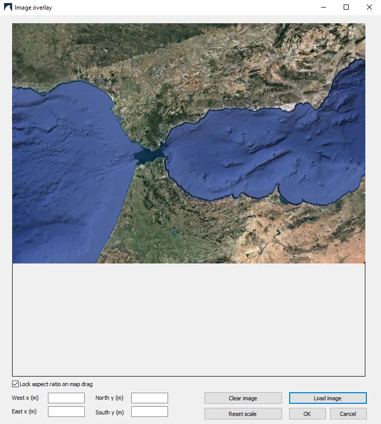
Image 1: The Image anchors form, here with a satellite image of the Strait of Gibraltar.
Options in the Image anchors form
Section titled “Options in the Image anchors form”-
Load image: Choose the image file. A matching world file is read automatically.
-
Lock aspect ratio on map drag: This option ensures that the image maintains its proportions while being moved on the map. If your bathymetry and image are in different projections, you may want to disable this.
-
West x (m), East x (m), North y (m), South y (m): These fields define the extent of the image overlay in the project’s coordinate system: the same easting and northing as the bathymetry (UTM metres if the project has a UTM zone, otherwise distances from the project origin). For the example above:
West x (m)is the Easting (UTM zone 30) of the most western part of the image.East x (m)is the Easting (UTM zone 30) of the most eastern part of the image.North y (m)is the Northing (UTM zone 30) of the most northern part of the image.South y (m)is the Northing (UTM zone 30) of the most southern part of the image.
-
Reset scale and Clear image restore the default extent or remove the overlay.
After pressing OK, the image overlay will appear in the main dBSea window. If the image is not positioned correctly, or no world file was found, choose Image overlay → Set on map and resize and reposition the image by dragging its corner handles. If “Lock aspect ratio on map drag” is checked, the image proportions cannot be altered.
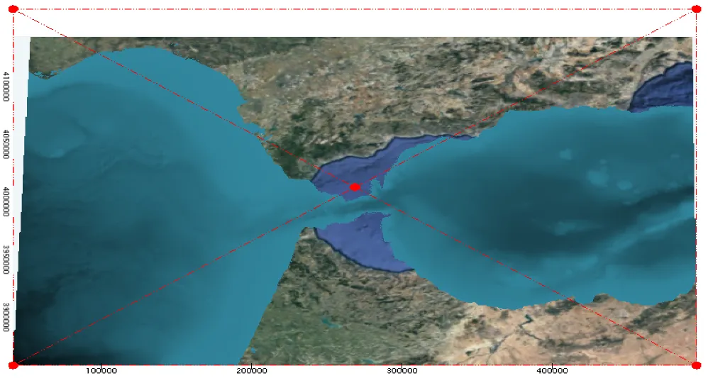
Image 2: The image being set on the map.